


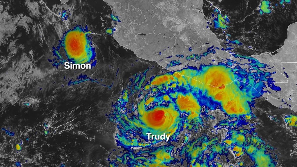
Hurricane Trudy lashed parts of Mexico's Pacific coast with heavy rain and strong winds on Sunday, 18 October, as a Category 2 storm with maximum sustained winds of 105 mph (165 kph), moving northwest at about 8 mph, according to the Associated Press. The US National Hurricane Center warned of potentially life-threatening flooding and mudslides, especially on steep terrain, and a tropical storm warning covered the Islas Marias and the coast between Playa Perula and San Blas. Forecasters expected 4 to 8 inches (10 to 20 centimetres) of rain through the weekend, with isolated totals near 12 inches (30 centimetres) along and near the coast in Michoacan, Colima and Jalisco. The centre was forecast to pass south of the Baja California peninsula on Monday and Tuesday.
The argument that Mexico's coast was well prepared begins with the warnings. The Mexican navy urged mariners and coastal residents to "exercise extreme caution", and the hurricane centre issued flood and mudslide warnings before the heaviest rain. Colima's civil protection authorities said the risks remained low, and the report gave no deaths. The storm also stayed near the coast and then moved away, passing offshore, and a category 2 storm with winds of 105 mph is below the intensity of the major hurricanes that cause the heaviest wind damage. At 8 mph, its movement was slow enough to be tracked and forecast, which gave residents days of notice. The hurricane centre and the navy also cited rising rivers and landslides as risks.
The argument that the danger was greater than the headline category is that rain, not wind, was the main threat. Colima's authorities also warned that earlier storms had already saturated the ground along the Pacific coast, so even moderate rain could cause damage. The remnants then moved north: the Denver Gazette reports that storms from Trudy's remnants began in southwest Colorado on 21 October, with 5.05 inches of rain at Pagosa Springs, 3.27 at Bayfield and 3.06 at Durango. The San Juan River at Pagosa Springs crested at 15.02 feet and stayed above flood stage for more than three days, hundreds of people were evacuated, and Governor Jared Polis declared a disaster emergency in 11 counties, later adding a twelfth. In Bluff, Utah, floodwaters hit 17 homes and five businesses.
The storm matters because it shows how a hurricane that does limited damage where it lands can cause more elsewhere. Water that fell on Mexico's coast became rain in the Four Corners region days later, and flooding reached wastewater plants and rivers, with officials advising people exposed to floodwater to wash as soon as possible. New Mexico reported a death in Santa Fe from a flooded arroyo and an estimate of up to $300 million in damage, though the report does not tie both to Trudy alone. The Pacific hurricane season continues, with another system, Simon, visible on satellite beside Trudy. In Colorado, portions of U.S. 550, U.S. 160, Colorado 151 and Colorado 112 were closed, and the National Guard and search and rescue crews checked on cut-off residents in Archuleta County by helicopter.
Trudy did less harm at landfall than feared, but its remnants showed that flood risk travels far inland. Preparation has to cover where the water ends up, not only where the storm arrives.